We covered a lot of ground and air in 2020! A dozen field techs contributed to one or more ground survey efforts in Glacier National Park. Due to COVID-19, we unfortunately weren’t able to ground survey areas in Akamina-Kishinena Provincial Park or Waterton Lakes National Park. However, we conducted our aerial surveys as planned, with five survey rounds across the transboundary study area. The following summarizes our results from the 2020 summer.
Aerial Surveys
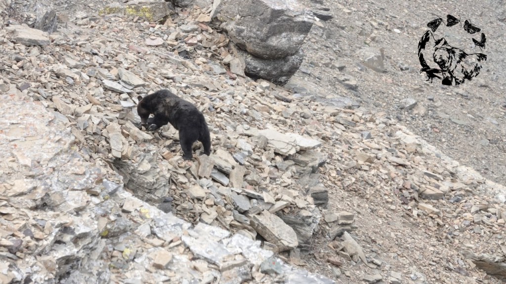
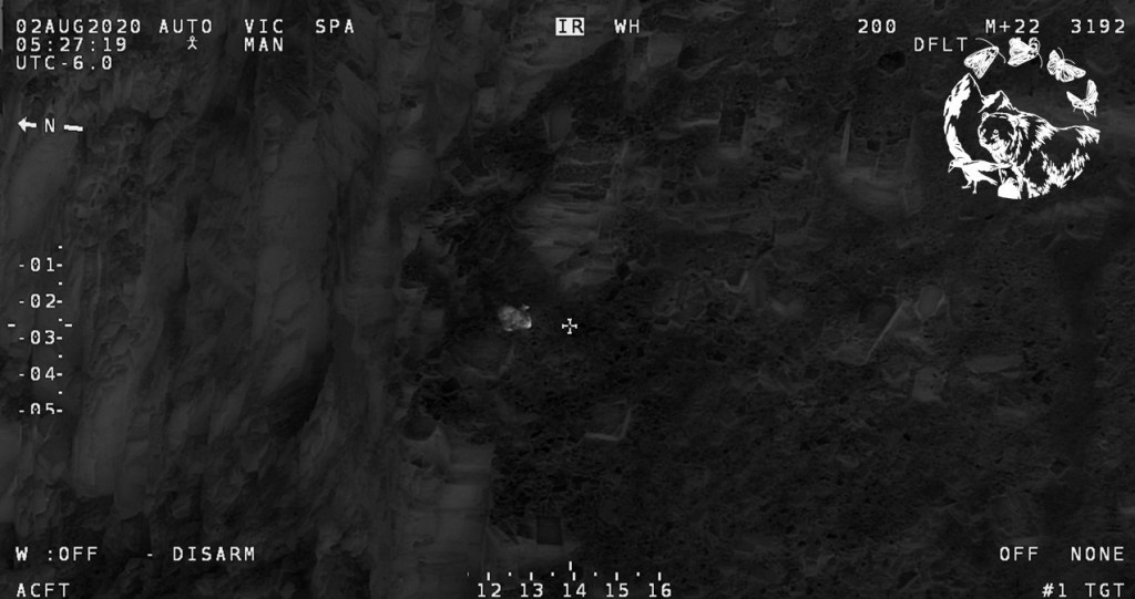
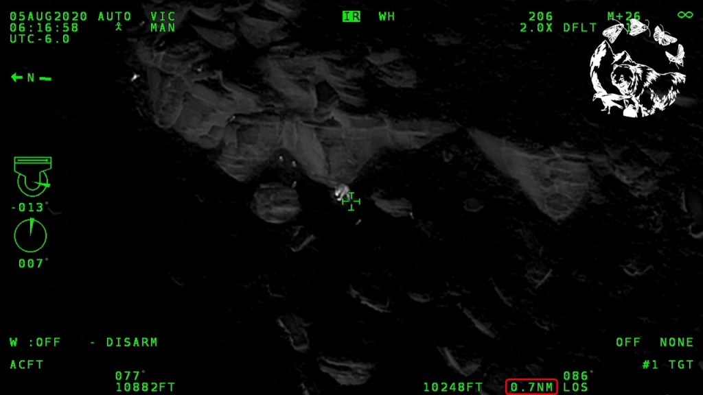
Helicopter surveys provide the bulk of our documented locations where grizzly bears forage for army cutworm moths (ACMs). The camera technology on-board Two Bear Air’s helicopter allows us to zoom in and record the behavior of individual grizzly bears at the time they are detected. We used this zoom capability to record moth foraging behavior at the time of first detection for 84% of grizzly bear observations. Without this technology, we’d be restricted to what an observer’s eye can see from the air (often just a moving brown-colored ball) and would have to record grizzly bear(s) in a similar location on multiple survey occasions to confirm locations are actual areas where grizzly bears feed on ACMs.
We conducted five two-day survey rounds of potential mothing talus slopes across our study area from mid-July to mid-September. The bulk of our bear detections occurred during two August survey rounds. In total, we recorded grizzly bear activity in 13 of 27 survey units via aerial surveys. Four of these units had no previous grizzly bear aerial survey detection.
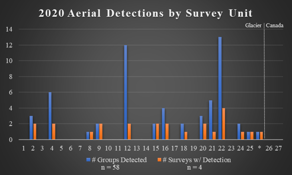
* denotes a bear observation outside a survey unit
Seventy eight percent of our 58 bear group detections were documented by the helicopter’s camera, with almost all of these being in infrared mode, as opposed to visible. Survey demographics were conservatively estimated, given the difficult nature in accurately estimating bear age classes from the air. Lone adults comprised 38% of observations. Twenty six percent of observations were females with cubs, while subadults made up 17%. The final 26% of observations were classified as unknown, or not distinguishable to age class.
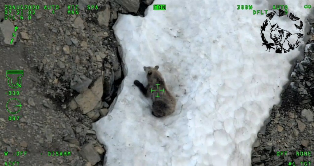
Minimizing bear disturbance is an important component of our survey methodology. The on-board camera allows us to detect grizzlies at a greater distance from the terrain, compared to the fixed-wing surveys our project initially conducted in 2019. A really cool component of the camera is that it laser-records the distance to an object in its cross hairs. Our average distance to bear observations was 965 meters. Our furthest distance was 1.4 miles (or 2250 meters)! As such, our incidence rate of helicopter caused displacement was just one-in-ten. On no occasion did a grizzly bear flee from an aggregation or abort foraging as a result of disturbance. Rather, in almost every instance we observed grizzlies moving a few paces and resorting back to foraging within seconds, before the camera panned away.
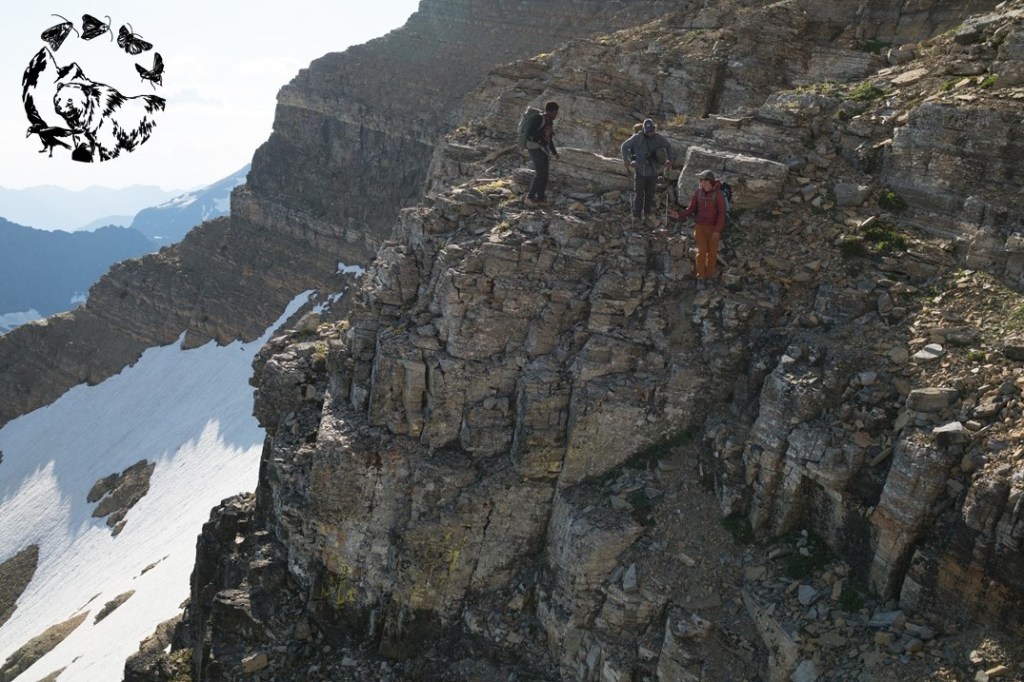
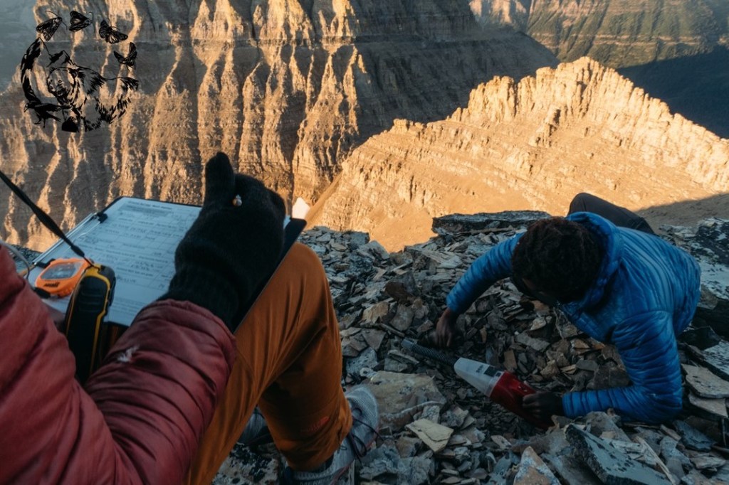
Ground Surveys
We performed ground surveys in 17 of 20 ground survey units, which are a subset of the 27 aerial survey units. Ground surveys were implemented to further document grizzly bear use, record army cutworm moth presence/abundance, and describe habitat characteristics. Technicians recorded data at 310 survey plots; 302 of these are suitable for analysis.
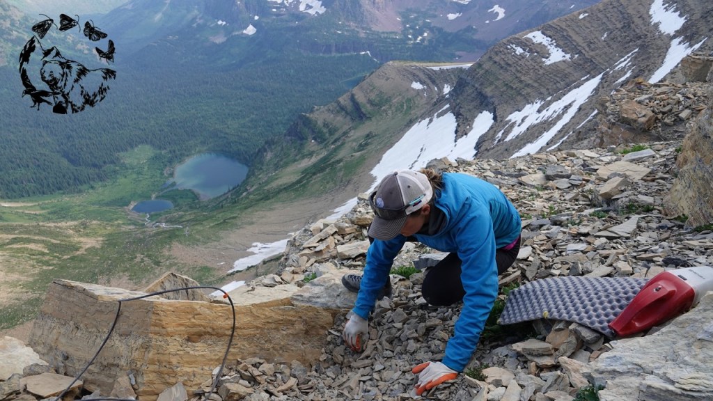
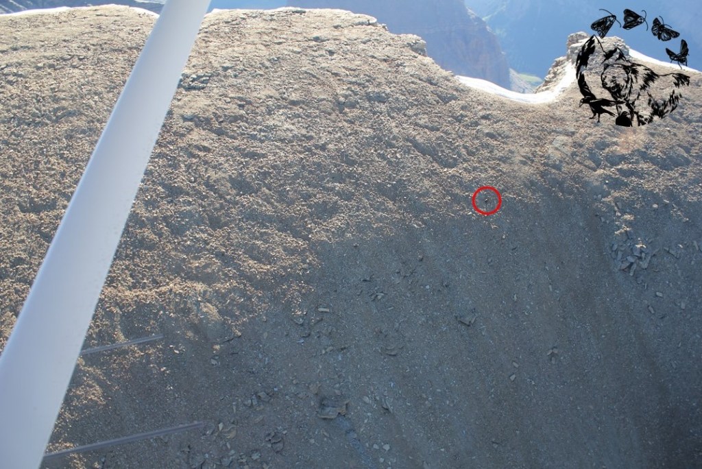
We recorded bear sign at 80 of 302 plots, spread over 14 of 17 survey units. Grizzly bear foraging (i.e. clumped digs in talus) was documented at 67 of the 80 plot locations. Of the 14 survey units where we recorded sign of grizzly bear moth foraging through ground surveys, five were located in survey units where no bears were observed during aerial surveys. It’s valuable to note bear dig evidence remains on the landscape for multiple years, so this sign cannot always be confirmed to the year it is observed, like with aerial survey detections.

We recorded ACM presence at 137 of 302 plots, spread across 15 of 17 survey units. At each plot, we conducted three moth-sampling experimental digs. Our three-dig sum of moth abundance ranged from 0 to 156. The three-dig average across all plots containing at least one moth was 15, with a median value of 5.
Habitat characteristics at survey plots where we detected ACMs showed patterns of occurrence. These locations were dominated by limestone talus slopes -77% of plots containing moths were in limestone. Red and green-colored argillite talus (the “pretty colored rock” in the park) was the other dominate geologic substrate. Compared to limestone, argillite talus tends to be smaller and flakier, which results in less air space between rocks on slopes. Indeed, we classified 90% of plots possessing moths as being dominated by large talus over small. We considered large talus to be rock that is field notebook-sized or larger. The air space within a talus slope, termed interstitial space, is an important component for ACMs. The more air space in the talus, the greater maneuverability moths are provided to crawl deep below the talus surface to a cool, temperature-stable depth for rest during the heat of the day. Unsurprisingly, the talus of plots with ACM’s also tended to be deeper. Last, we laser-estimated ACM-positive survey plots as being closer to visible snowmelt or snow patches. As snowpack melts over summer months, it reasons subsurface talus locations closer to moisture will remain cooler, longer.

Combining Ground & Aerial Surveys
Our two-pronged survey approach to documenting grizzly bear use of potential ACM habitat proved to be a valuable approach to gain knowledge of where these locations are found across our study area in a short period of time. Merging these data, we documented bear foraging in two-thirds of our study area’s survey units (18 of 27). In 2021, we will conduct another summer of aerial surveys across the study area’s 27 survey units, which may increase the number of survey units with documented grizzly bear foraging for ACMs.